
[vc_row type=”in_container” full_screen_row_position=”middle” scene_position=”center” text_color=”dark” text_align=”left” overlay_strength=”0.3″ shape_divider_position=”bottom”][vc_column column_padding=”no-extra-padding” column_padding_position=”all” background_color_opacity=”1″ background_hover_color_opacity=”1″ column_shadow=”none” column_border_radius=”none” width=”1/1″ tablet_text_alignment=”default” phone_text_alignment=”default” column_border_width=”none” column_border_style=”solid”][vc_column_text]
The Main Trails
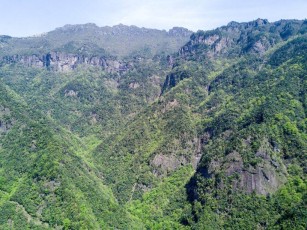
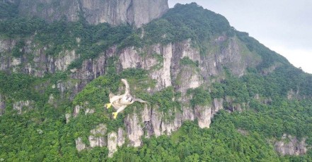
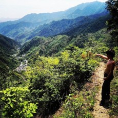
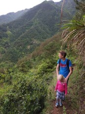
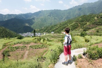
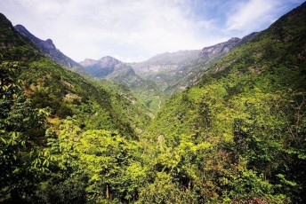
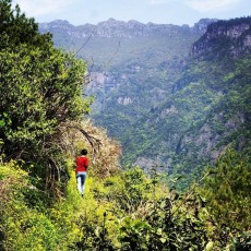
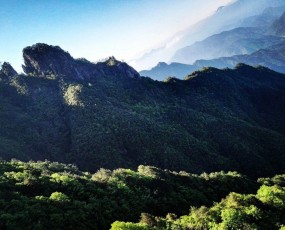
 To the East of Wildhomestay we have some very nice trails over to Santang which borders the Qingliangfeng National Nature Reserve. To the south there are some longer trails which meet up with the Damingshan and southen hills leading to Qiandao Lake. To the West we have many nice trails leading to Yenke, Gaosheng and Shuizhuken. To the North we have trails leading around the boarder of the nature reserve to Jixi and northern hills.[/vc_column_text][/vc_column][/vc_row][vc_row type=”in_container” full_screen_row_position=”middle” scene_position=”center” text_color=”dark” text_align=”left” overlay_strength=”0.3″ shape_divider_position=”bottom”][vc_column column_padding=”no-extra-padding” column_padding_position=”all” background_color_opacity=”1″ background_hover_color_opacity=”1″ column_shadow=”none” column_border_radius=”none” width=”1/1″ tablet_text_alignment=”default” phone_text_alignment=”default” column_border_width=”none” column_border_style=”solid”][vc_column_text]
Local Trails
 There are many local routes. Go explore or a few suggestions:
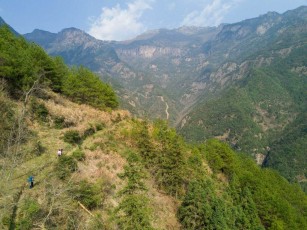
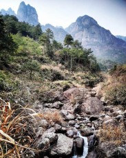
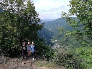
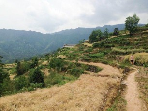
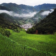
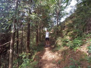
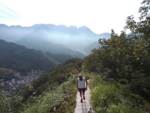
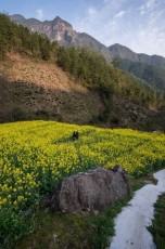
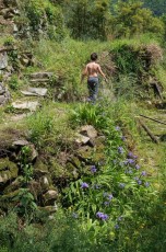
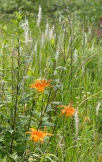
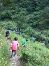
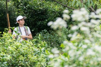
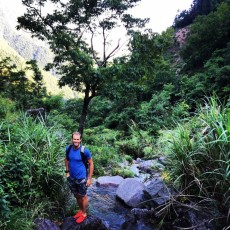
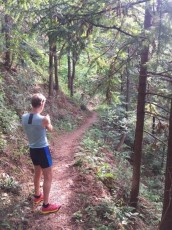
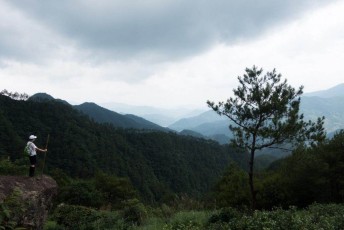
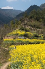
For an easy walk, go west out of Wildhomestay, walk up the west trail (past the play area) to the tea trail. Great views over to Qingliangfeng. Then circle down the vomit run or add a few more KM’s and take the forest trail. Want even more KM’s and hike over to Yuanke, have lunch at someones home and walk back or we will organize a car. Near Yenke there are many nice trails to hidden villages, streams, and forests.
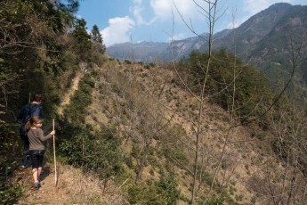
An alternative / next day is to walk over the east trail, down and then up to Santang. There are many routes around the base of Qingliangfeng.[/vc_column_text][/vc_column][/vc_row][vc_row type=”in_container” full_screen_row_position=”middle” bg_image=”6406″ bg_position=”left top” bg_repeat=”no-repeat” scene_position=”center” text_color=”light” text_align=”center” overlay_strength=”0.3″ shape_divider_position=”bottom” shape_type=””][vc_column column_padding=”padding-10-percent” column_padding_position=”all” background_color_opacity=”1″ background_hover_color_opacity=”1″ column_shadow=”none” column_border_radius=”none” width=”1/1″ tablet_text_alignment=”default” phone_text_alignment=”default” column_border_width=”none” column_border_style=”solid”][vc_column_text css=”.vc_custom_1528802212851{background-color: rgba(73,73,73,0.54) !important;*background-color: rgb(73,73,73) !important;}”]
Hiking & Running Route Page
For registered guests please go to this link to download GPX tracks. Then open them in wikiloc, viewranger, osmand or a phone app of your choosing or your GPS device.[/vc_column_text][/vc_column][/vc_row][vc_row type=”in_container” full_screen_row_position=”middle” scene_position=”center” text_color=”dark” text_align=”left” overlay_strength=”0.3″ shape_divider_position=”bottom”][vc_column column_padding=”no-extra-padding” column_padding_position=”all” background_color_opacity=”1″ background_hover_color_opacity=”1″ column_shadow=”none” column_border_radius=”none” width=”1/1″ tablet_text_alignment=”default” phone_text_alignment=”default” column_border_width=”none” column_border_style=”solid”][vc_column_text]Gallery


[/vc_column_text][/vc_column][/vc_row][vc_row type=”in_container” full_screen_row_position=”middle” scene_position=”center” text_color=”dark” text_align=”left” overlay_strength=”0.3″ shape_divider_position=”bottom”][vc_column column_padding=”no-extra-padding” column_padding_position=”all” background_color_opacity=”1″ background_hover_color_opacity=”1″ column_shadow=”none” column_border_radius=”none” width=”1/1″ tablet_text_alignment=”default” phone_text_alignment=”default” column_border_width=”none” column_border_style=”solid”][vc_column_text]Interactive Map (coming soon)[/vc_column_text][/vc_column][/vc_row][vc_row type=”in_container” full_screen_row_position=”middle” scene_position=”center” text_color=”dark” text_align=”left” overlay_strength=”0.3″ shape_divider_position=”bottom”][vc_column column_padding=”no-extra-padding” column_padding_position=”all” background_color_opacity=”1″ background_hover_color_opacity=”1″ column_shadow=”none” column_border_radius=”none” width=”1/1″ tablet_text_alignment=”default” phone_text_alignment=”default” column_border_width=”none” column_border_style=”solid”][vc_column_text]
[/vc_column_text][/vc_column][/vc_row][vc_row type=”in_container” full_screen_row_position=”middle” scene_position=”center” text_color=”dark” text_align=”left” overlay_strength=”0.3″ shape_divider_position=”bottom”][vc_column column_padding=”no-extra-padding” column_padding_position=”all” background_color_opacity=”1″ background_hover_color_opacity=”1″ column_shadow=”none” column_border_radius=”none” width=”1/1″ tablet_text_alignment=”default” phone_text_alignment=”default” column_border_width=”none” column_border_style=”solid”][vc_column_text]Warning Nature Reserve – keep out of core and buffer!!!
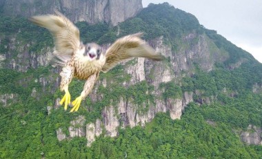
Warning Dangers – there are snakes and rocks/mountains you can fall off.
Warning Hydration – bring enough drinking water or filter system for your hikes and runs.[/vc_column_text][/vc_column][/vc_row]